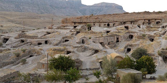
Kerman (Persian: كرمان, romanized: Kermân [kʲeɾˈmɒːn] ; also romanized as Kermun and Karmana), known in ancient times as the satrapy of Carmania, is a city in the Central District of Kerman County, Kerman province, Iran, serving as capital of the province, the county and the district.
At the 2006 National Census, its population was 496,684 in 127,806 households. The following census in 2011 counted 534,441 people in 147,922 households. The latest census in 2016 showed a population of 537,718 people in 162,677 households.
It is the largest and most developed city in the province and one of the most important cities in southeastern Iran. It is also one of the largest cities of Iran in terms of area. Kerman is famous for its long history and strong cultural heritage. The city is h...Read more
Kerman (Persian: كرمان, romanized: Kermân [kʲeɾˈmɒːn] ; also romanized as Kermun and Karmana), known in ancient times as the satrapy of Carmania, is a city in the Central District of Kerman County, Kerman province, Iran, serving as capital of the province, the county and the district.
At the 2006 National Census, its population was 496,684 in 127,806 households. The following census in 2011 counted 534,441 people in 147,922 households. The latest census in 2016 showed a population of 537,718 people in 162,677 households.
It is the largest and most developed city in the province and one of the most important cities in southeastern Iran. It is also one of the largest cities of Iran in terms of area. Kerman is famous for its long history and strong cultural heritage. The city is home to many historic mosques and Zoroastrian fire temples. Kerman has been the capital city of Iranian dynasties several times during its history. It is located on a large, flat plain, 800 km (500 mi) south-east of Tehran, the capital of Iran.
Kerman was founded as a defensive outpost, with the name Veh-Ardashir, by Ardashir I, founder of the Sasanian Empire, in the 3rd century AD.[1] After the Battle of Nahāvand in 642, the city came under Muslim rule. At first the city's relative isolation allowed Kharijites and Zoroastrians to thrive there, but the Kharijites were wiped out in 698, and the population was mostly Muslim by 725. Already in the eighth century the city was famous for its manufacture of cashmere wool shawls and other textiles. The Abbasid Caliphate's authority over the region was weak, and power passed in the tenth century to the Buyid emirs. The region and city fell to Mahmud of Ghazni in the late tenth century. The name Kerman was adopted at some point in the tenth century.[2]
 Dirham of Abbasid caliph al-Mahdi ibn al-Mansur, 8th century. Silver 2.95 g
 The Rayen Castle, the second largest brick building in the world
Under the rule of the Seljuk Turks in the 11th and 12th centuries, Kerman remained virtually independent, conquering Oman and Fars.[3] When Marco Polo visited Kerman in 1271, it had become a major trade emporium linking the Persian Gulf with Khorasan and Central Asia.[4] Subsequently, however, the city was sacked many times by various invaders. Kerman expanded rapidly during the Safavid dynasty. Carpets and rugs were exported to England and Germany during this period.[5]
In 1793 Lotf Ali Khan defeated the Qajars, and in 1794 he captured Kerman. But soon after he was besieged in Kerman for six months by Agha Mohammad Khan Qajar. When the city fell to Agha Mohammad Khan, angered by the popular support that Lotf Ali Khan had received,[clarification needed] many of the male inhabitants were killed or blinded, and a pile was made out of 20,000 detached eyeballs and poured in front of the victorious Agha Mohammad Khan.[6] Many women and children were sold into slavery, and in 90 days the city turned into ruins. However, the Zoroastrians of Kerman who had been strong supporters of Lotf Ali Khan suffered the wrath of the founder of Qajar dynasty the most during this period.
 The Masjid gate through which Agha Mohammad Khan entered the city
The present city of Kerman was rebuilt in the 19th century to the northwest of the old city, but the city did not return to its former size until the 20th century.


Add new comment