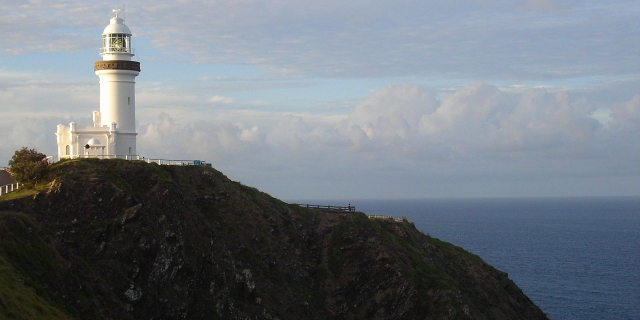
Fraser Island
K'gari ( GAH-ree), also known by its historic name, Fraser Island, is a World Heritage-listed sand island along the south-eastern coast in the Wide Bay–Burnett region, Queensland, Australia. The island is approximately 250 km (160 mi) north of the state capital, Brisbane, and is within the Fraser Coast Region local government area. The world heritage listing includes the island, its surrounding waters and parts of the nearby mainland which make up the Great Sandy National Park
The island is part of the traditional lands of the Butchulla people, under the traditional name of "K'gari". European settlers who arrived in 1847 named the island "Fraser Island" after Captain James Fraser, master of Stirling Castle, who was shipwrecked and died on the island in early August 1836....Read more
K'gari ( GAH-ree), also known by its historic name, Fraser Island, is a World Heritage-listed sand island along the south-eastern coast in the Wide Bay–Burnett region, Queensland, Australia. The island is approximately 250 km (160 mi) north of the state capital, Brisbane, and is within the Fraser Coast Region local government area. The world heritage listing includes the island, its surrounding waters and parts of the nearby mainland which make up the Great Sandy National Park
The island is part of the traditional lands of the Butchulla people, under the traditional name of "K'gari". European settlers who arrived in 1847 named the island "Fraser Island" after Captain James Fraser, master of Stirling Castle, who was shipwrecked and died on the island in early August 1836. On 7 June 2023, the island was officially renamed K'gari after a decade of advocacy from the Butchulla people.
In the 2021 census, the island had a population of 152 people. Up to 500,000 people visit the island each year.
 Fraser Island: locator mapTraditional owners
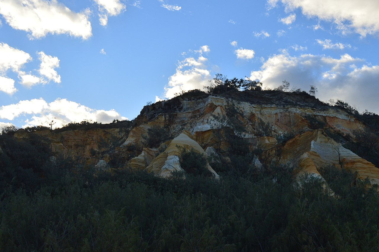
The lands that include the current day island have been inhabited for at least 60,000 years by the Butchulla people.[1][2][3][4] Originally attached to the mainland, K'Gari became an island 10,000—20,000 years ago during rising seas.[4][5]
The K'gari creation story, told by Olga Miller, a direct descendent and Elder of the Butchulla people, is that Yendingie (also spelling Yindingie) came down from the sky and set to work to make the sea and then the land until, when he arrived at the area now known as Hervey Bay, he was joined by a helper - as beautiful white spirit called Princess K'gari.[6] Tired by their work together he changed her into a beautiful island, then:
So she wouldn't be lonely, he then made some beautiful trees and flowers, and some lakes that were specially mirrored so that she could see into the sky. He made creeks and laughing waters that would become her voice, and birds and animals and people to keep her company. He gave these people knowledge and laws, and told them what to do, and how to procreate, so that their children and ancestors would always be there to keep K'gari company.
Butchulla (also known as Batjala, Badtjala, Badjela and Badjala) is the language of the Fraser Coast region, including the island.[7] Butchulla language region includes the landscape within the local government boundaries of the Fraser Coast Regional Council, particularly the towns of Maryborough and Hervey Bay extending south towards Noosa.[7]
Archaeological research and evidence shows that Aboriginal Australians occupied K'gari at least 5,000 years ago. There was a permanent population of 400–600 that grew to 2,000–3,000 in the winter months due to abundant seafood resources.[8] Conflict with European settlers and disease reduced the population from 435 in 1872 to 230 in 1880. Most of these people were taken off the island in 1904 and relocated to missions in Yarrabah and Durundur (near Caboolture).[9][10]
It is estimated that up to 500 indigenous archaeological sites are located on the island.[11]
British exploration (1770–1840s)Initial European contact was limited to explorers and shipwrecks. The first recorded Briton to sight K'gari was James Cook who passed along the coast of the island between 18 and 20 May 1770. He named Indian Head after viewing a number of Aboriginal people gathered on the headland. After Cook's passage an Aboriginal song was composed to commemorate the event. This was later recognised as the first preserved oral testimony of Indigenous observation of Europeans.[12] Matthew Flinders sailed past the island in 1799, and again in 1802, this time landing at Sandy Cape,[13] while charting Hervey Bay. His 1814 chart is a combination of both voyages, but did not confirm K'gari as being separate from the mainland. However, Flinders did suggest the presence of shallow swampy areas at the lower part of the bay. Flinders was told of an opening at Hook Point, between K'gari and the mainland, by two American whalers who were hunting whales in Hervey Bay.[14] In 1842, Andrew Petrie recorded good pastoral lands and forests, attracting graziers to the region.[15] Lieutenant Robert Dayman was the first European to sail between K'gari and the mainland in 1847.[16]
Shipwreck; Eliza Fraser (1836)Captain James Fraser and his wife, Eliza Fraser, of England, were shipwrecked on the island in 1836. Their ship, the brig Stirling Castle, set sail from Sydney to Singapore with 18 crew and passengers. The ship was holed on coral while travelling through the Great Barrier Reef north of the island.[17] Transferring to two lifeboats, the crew set a course south, attempting to reach the settlement at Moreton Bay (now Brisbane). During this trip in the leaking lifeboats, Captain Fraser's pregnant wife gave birth in water up to her waist; the infant drowned after birth. The Captain's lifeboat began sinking and was soon left behind by the second one, which continued on. The wrecked boat and its crew was beached on what was then known as the Great Sandy Island.[18]
Captain Fraser died, leaving his wife Eliza and the second mate Mr Baxter living among the local peoples. Eliza and Baxter were found six weeks later by a convict, John Graham,[19] who had lived in the bush as an escapee and who spoke the Aboriginal language. He was sent from the settlement at Moreton Bay by the authorities there who had heard about their plight, and negotiated their return.[20][18]
Within six months, Eliza had married another sea captain. She returned to England and became a sideshow attraction in Hyde Park, telling ever more lurid tales about her experiences with the enslavement of the crew, cannibalism, torture, and murder. As she is known to have told several versions of the story, it is unknown which (if any) version was most accurate.[21][22] It has been suggested that she was killed in a carriage accident during a visit to Melbourne in 1858.[17]
Fraser's stories were disputed, by other survivors[who?] at the time and afterwards.[23][24] On her return to England, Fraser appealed for money to the Lord Mayor of London, claiming to be a penniless widow in need, but the subsequent inquiry revealed that prior to leaving Sydney she had both remarried an English captain with whom she returned, and also there received a large sum of charitable funds in light of her ordeal.[25]
Frontier conflict (1851–1860)Non-Indigenous settlement of the traditional Butchulla mainland area began in 1847, sparking frontier conflict. Violence between Indigenous people and non-Indigenous people was reported.[26] In October 1850, it was reported "blacks [sic] had driven away 2000 sheep from a station about forty miles from here, and had killed a shepherd".[27] In 1851, a small government-led force including Commandant Frederick Walker and a contingent of the Native Police were called in "for the purpose of endeavouring to apprehend some aboriginal natives [sic] who stand charged with various offences, and who have hitherto found shelter in the scrub" of Fraser Island.[28] Frontier war was anticipated, condoned, and facilitated by the government, with Walker receiving advice from the Attorney-General of New South Wales, John Hubert Plunkett saying, "It must, unhappily, be expected that the proposed attempt at arrest may lead to a warlike conflict and perhaps to loss of life, but the aim of the law must not be paralysed by the expectation of such results".[29]
The force included Walker, Lieutenant Richard Marshall, Sergeant Doolan, three divisions of troopers, and armed locals including James Leith Hay, aboard a schooner. A boat reputedly stolen by "the blacks [sic] from Maryborough" was captured along the way.[30] The force landed on the west coast of the island where the divisions split up. During the night, conflict began and a number of Indigenous people were shot and others captured. The weather was bad and Commandant Walker allowed his division to track down other groups without him. This group tracked a group of Indigenous people across the island to the east coast where they pursued them into the open ocean near Indian Head/Tacky Waroo to an unknown fate. After months of conflict, the force returned to Maryborough in early January 1852 and Captain Currie received a reward of £10 for his contribution.[31] According to Native Police reports, operations on Fraser Island during 24 December 1851 and 3 January 1852 were lawful, and only two Indigenous people were killed while attacking Walker's police party on the night of 27 December 1851.[32] Academics as well as community advocates have demonstrated that the word dispersed was often used regardless of the actual results of clashes between Native Police and Indigenous Australians and the pursuing of Indigenous people into the sea at Indian Head/Tacky Waroo was most likely a massacre as the relevant report states that the Butchulla were "dispersed into the sea".[33][34]
British commissioners stationed in Maryborough reported non-Indigenous occupants felt threatened by Butchulla people.[35] In 1857, a Native Police barracks under the command of Lieutenant John O'Connell Bligh was established at Coopers Plains, now Owanyilla, not far from Maryborough. Bligh conducted further forays into Fraser Island,[36] Cooloola, and in the town of Maryborough itself.[37]
The "white girls" (1859)In 1859 rumours of two shipwrecked "white" girls living with Butchulla people on Fraser Island gained some credence when Captain Arnold of Coquette arrived in Sydney with information seeming to confirm the story.[38] Public interest was stirred and Arnold was requested by the government of the Colony of New South Wales to return to the island with a rescue party, obtaining the right to a £200 bonus if the girls were brought back. The expedition was carried out with the aid of an Aboriginal man named Tommy, who identified the Aboriginal camp near Indian Head where two girls aged about 12 and 18 were located and captured.[39] On taking them to Sydney, it became evident through their appearance and through their complete lack of knowledge of the English language that the girls were likely Aboriginal "half-castes". Edward Preddy of the rescue party wrote that "they could not converse with any of us, nor did they seem capable of talking with the blacks."[36] Arthur Macalister stated that he "thought it very probable that these girls were half castes, and that the whole thing was a trick".[40] Further discredit was placed on the process when it was found that the Aboriginal people who were paid by the search party to find the girls were rewarded in worthless commemorative coins instead of real money.[41] The girls, "Kitty" Mundi and "Maria" Quoheen/Coyeen, were not returned to their home but were initially kept at the Immigration Depot, where they yearned for their family.[42] Kitty, the eldest of the two, suffered severe mental distress and died shortly afterwards. Maria survived for about 20 years, dying from pulmonary tuberculosis.[43]
Aboriginal internment camp (1897–1904) Shelters at Boggimbah, Fraser Island, 1902. John Oxley Library, State Library of Queensland. Negative number: 107735.
In 1897, as part of the implementation of the Aboriginals Protection and Restriction of the Sale of Opium Act 1897, the Government of Queensland moved 51 Indigenous people who had been deemed to have "reached a deplorable stage of degradation, being completely demoralised by drink, opium, disease, and intermittent periods of semi-starvation" from the Maryborough district to a camp on the west coast of Fraser Island. The main bureaucrat in charge of the relocations of Indigenous people in Queensland at the time, Archibald Meston, transported the 51 men, women and children to a defunct quarantine station at White Cliffs (Beerillbee) about 2 km south of the present day Kingfisher Bay Resort.[44] However, white residents of Maryborough made incursions into the camp area and caused tension and flare ups[45] which resulted in the relocation of the camp 10 km north to Bogimbah creek.[46] The Queensland Government ran the Bogimbah site under the direction of Archibald Meston's son and wife until February 1900, when control was handed over to the Australian Board of Missions.[47] By this time, Bogimbah had become an incarceration facility for Indigenous people from around Queensland, it was described as a hell hole of deprivation, lacking medical supplies, food and shelter and mosquito born diseases were prevalent.[48] At the end of 1899 there were 137 Indigenous people from 25 different locations, including some who had served prison sentences in places like St Helena Island and Townsville Gaol and had been refused permission to return to their homes.[49] A former Native Police trooper named Barney, who had assisted in the operations to capture Ned Kelly, was sent to Bogimbah but drowned there not long after in a boating accident.[50]
 Archibald Meston. John Oxley Library, State Library of Queensland. Negative Number 17065.
Conditions at Bogimbah were dire, with inadequate shelter and rations.[51] Inmates frequently tried to escape to the mainland in order to get access to better food and obtain employment. Some died through malnutrition, pulmonary tuberculosis and geophagia.[52] In 1904, in order to save money on funding to the Missions Board, the Queensland Government decided to shut the Bogimbah facility.[53] Of the 145 Indigenous people counted at the time of closure, 94 were transferred to the Yarrabah facility near Cairns, 33 to the Durundur facility near Woodford, 9 were kept local and another 9 escaped or were sent elsewhere.[54] Those who were removed to Yarrabah were transported by the Rio Loge and there appears to have been deceptive techniques involved in getting the people to separate from loved ones.[55] Once in Yarrabah, similarly poor living standards greeted these people and those who become troublesome were transferred to Fitzroy Island.[56]
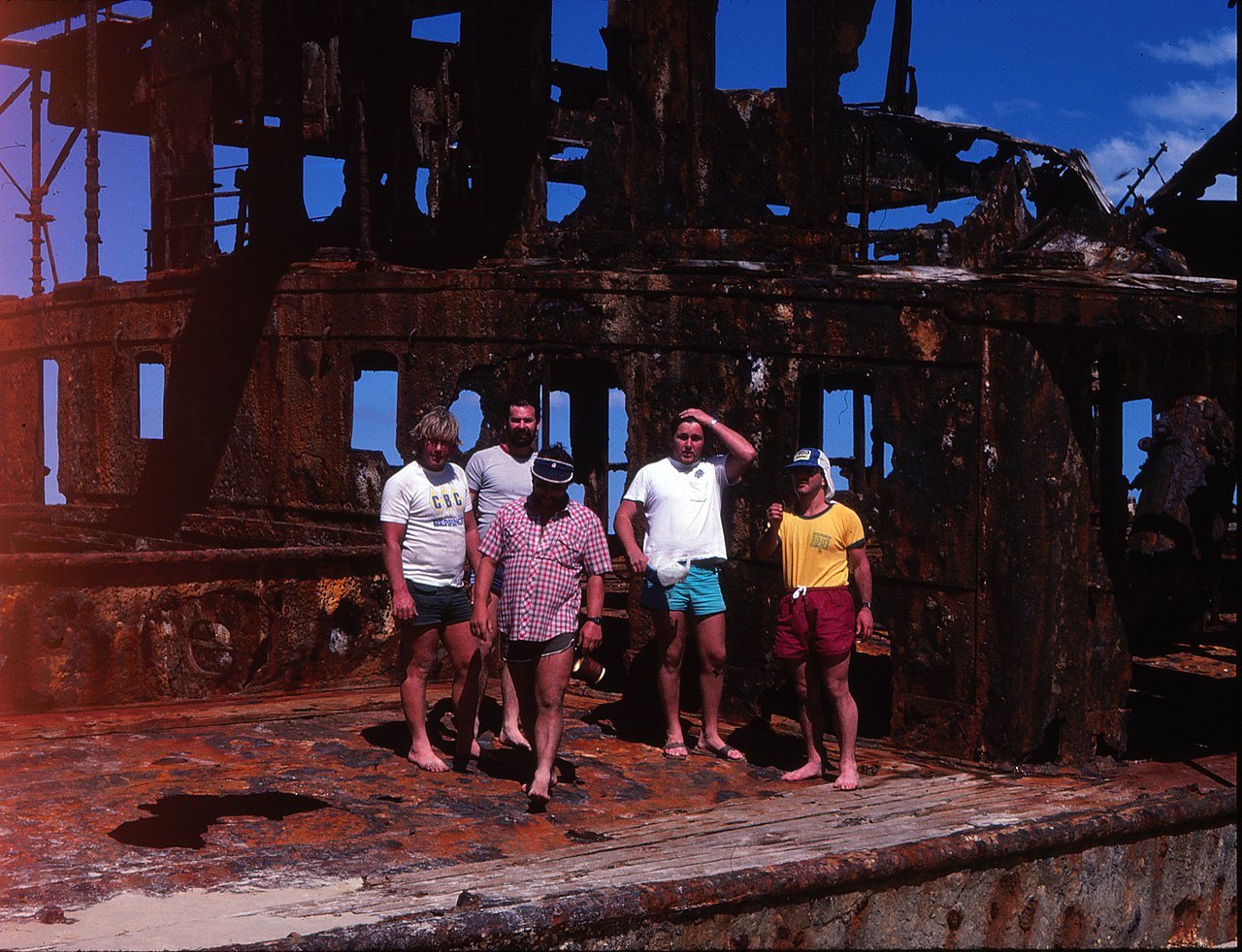
Wreck of Maheno (1935) The wreck of SS Maheno near Eli Creek, 2019
A major landmark on Fraser Island is the shipwreck of SS Maheno. Maheno was built in Scotland in 1905 as a luxury passenger ship for the trans-Tasman crossing. During World War I it served as a hospital ship in the English Channel, and was then returned to its owners to resume usual commercial operation. By 1935 the ship had been taken out of service and was sold to a ship-breaker in Japan. On 25 June 1935, while being towed to Osaka to be broken up, the ship was caught in a strong cyclone about 80 km (50 mi) off the coast of Queensland. The towline parted, and on 9 July 1935 Maheno became beached on the east coast of Fraser Island.[citation needed]
During World War II the wreck served as target bombing practice for the RAAF and was used as an explosives demolition target by special forces from the Fraser Commando School. The remains of the ship are now severely rusted, with almost three and a half storeys buried under the sand. Because of the danger it poses, climbing on the wreck is not permitted.[57]
Fraser Commando School (WW2)During World War II, the area near McKenzie's Jetty was used by the Services Reconnaissance Department (popularly known as "Z Special Unit") as a special forces training camp – the Fraser Commando School. Thousands of soldiers were trained here because the conditions were similar to those found on Pacific Islands where the Japanese were fought.[58] Lake McKenzie was used for parachute training and the wreck of Maheno was used for explosive demolitions practice.[citation needed]
Visitors to the site of the Fraser Commando School today can still see various relics of its military past including armour plates used to test armour piercing explosive charges and weapons and a concrete relief map of Singapore Harbour used as an aid in operations planning.[citation needed]
Nauru resettlement proposition (1961)As part of ongoing meetings in the United Nations Trusteeship Council on the "Conditions in the Trust Territories", the Republic of Nauru expressed concern that its phosphate mining exportation would be depleted by the end of the century, endangering the future of the island.[59][60] In 1961, Fraser Island was proposed by Australia as a location for the resettlement of the entire population of the Republic of Nauru. The timber industry on Fraser Island managed to ensure that resettlement on Fraser Island did not proceed.[61] In 1964 in the 31st session of United Nations Trusteeship Council meetings it was concluded that Curtis Island could provide a more satisfactory resettlement for the population of Nauru.[60] Nauru rejected the offer of moving the entire population to Curtis Island due to political independence considerations that Australia would not agree to.[59] When visiting the island in 1964, the head of the Nauru delegation, Hammer de Roburt, insisted on this point of sovereignty in order to protect his people from the overt racism that he himself experienced on this tour.[62] Although a resettlement never did occur, the Republic of Nauru went on to achieve independence on 31 January 1968.[citation needed]
World Heritage Site (1992)In 1992, Fraser Island was listed as a UNESCO World Heritage Site.[63] In 2021, the listing was updated to add the traditional Butchulla Aboriginal name of K'gari[64] as well as the island's colonial name of Fraser Island. In 2009, as part of the Q150 celebrations, Fraser Island was announced as one of the Q150 Icons of Queensland for its role as a "natural attraction".[65]
Native title (2014)In October 2014, native title rights were granted to the Butchulla people by the Federal Court. This enables Butchulla people to hunt, fish, and take water for domestic purposes; and opens the island up to economic opportunities for current and future generations of Butchulla people through ecotourism and related business development.[66]
2020 bushfireOn 14 October 2020, a large bushfire was started on the island by an illegal campfire. It impacted multiple communities and caused residents to flee their homes as it burned out of control.[67]
In early December interstate assistance, including from the New South Wales Rural Fire Service (NSWRFS) who provided a Boeing 737-300 Large Air Tanker waterbombing aircraft, was used to fight the fire as Happy Valley township was threatened. High temperatures, 32 °C (90 °F), and strong winds hindered fire fighting and Queensland Fire and Emergency Services (QFES) Director Brian Cox said "A lot of this fire is burning in inaccessible country ...".[68]
Heavy rainfall in mid-December helped contain the fire and the QFES was able to hand control back to the Queensland Parks and Wildlife Service (QPWS).[69] This was the longest burning fire of the 2020–21 bushfire season up to 14 December 2020 as it had been burning since October, over two months, and as of that date, more than half the island had been "blackened" by fire.[70]
The island reopened to tourists on 15 December. The fire was still burning, but the island was declared safe for visitors, though some walking trails and burner areas were still restricted for safety.[70] It is expected that the burned areas will successfully regenerate.[71]


![[node:title]](/sites/default/files/styles/640x320/public/default_images/default_0.JPG?itok=nAKl_DR1)
. - CC BY-SA 3.0")


Add new comment