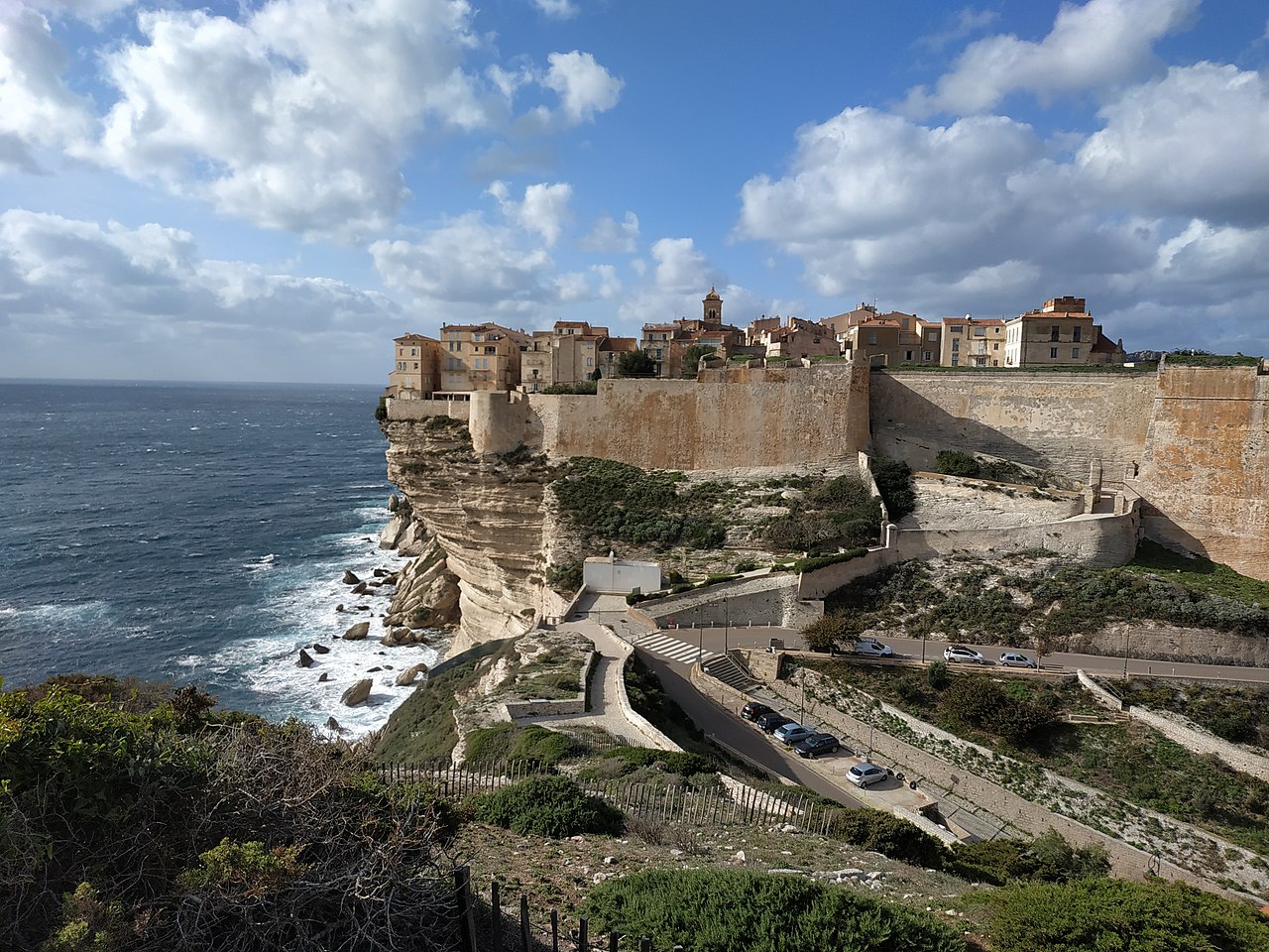
Bonifacio, Corse-du-Sud


Bonifacio (, Italian: [boniˈfaːt͡ʃo], French: [bɔnifasjo]; Corsican: Bunifaziu [buniˈfatsju], Bonifaziu [bɔniˈfatsju], or Bonifaciu [bɔniˈfaːt͡ʃu]; Bonifacino: Bunifazziu; Gallurese: Bunifaciu) is a commune in th...Read more
Bonifacio (, Italian: [boniˈfaːt͡ʃo], French: [bɔnifasjo]; Corsican: Bunifaziu [buniˈfatsju], Bonifaziu [bɔniˈfatsju], or Bonifaciu [bɔniˈfaːt͡ʃu]; Bonifacino: Bunifazziu; Gallurese: Bunifaciu) is a commune in the southern tip of the island of Corsica, in the French department of Corse-du-Sud.
Bonifacio is the setting of Guy de Maupassant's short story "Vendetta".
The French leg of the Red Bull Cliff Diving World Series takes place in Bonifacio.


Bonifacio has two prehistoric sites of some importance: the ancient cave shelter of Araguina-Sennola near the village of Capello on Route N96 just north of the city and a chambered tomb of Vasculacciu further north near Figari. The first is the site of the notable Lady of Bonifacio, a female burial carbon-dated to about 6570 BC, which is either late Mesolithic or Early Neolithic, and the second belongs to the Megalithic Culture and is dated to the Middle Neolithic. The alignment of the two and the extensive use of chert from Monte Arci in Sardinia shows that the Bay of Bonifacio was a route to inland Corsica from the earliest times.
Roman periodThe only record of southernmost Corsica in Roman times comes from the geographer Ptolemy. He reports[1] the coordinates of Marianum Promontory and town, which, plotted on a map, turn out to be the farthest south of Corsica. After listing the peoples of the east coast he states that the Subasani (ancient Greek Soubasanoi) were "more to the south."
The people do not appear subsequently and the town and promontory have not been identified, nor do any Roman roads point to it. The only official road, the Via Corsica, ran between the Roman castra of Mariana and Aleria on the east coast and further south to Pallas, according to the Antonine Itinerary.[2] Ptolemy places Pallas unequivocally on the east coast north of Marianum. Although unrecorded tracks and paths to the far south are possible, it is unlikely they would have carried any significant Roman traffic.
Maritime traffic through the strait however was significant and it could hardly have neglected the fine harbour at Bonifacio. The most popular choice for Marianum Promontory therefore is Cape Pertusato, southernmost point of Corsica island, about 9 kilometers (6 mi) east of the harbor, with Bonifacio itself as Marianum town.[3] A second possibility would be the first century AD Roman ruins adjoining Piantarella Beach near the village of Ciappili and next to the grounds of Sperone golf course, a recreational suburb to the west of Bonifacio, but those ruins appear to represent a Roman villa and the beach though eminently suitable for recreation is of little value as a port. More likely the villa belonged to a citizen of Bonifacio as Marianum.
Tuscan periodCorsica was taken from the Roman Empire in 469 AD by Genseric, king of the Vandals, and recovered by the Eastern Empire in 534. The Lombards having taken it again in 725, Charlemagne cleared them out by 774 and handed the island over to the Papacy, which had been the most powerful complainant of the island's devastation by Germanics. Starting in 806 the Moors of Spain began to contend for the island and held it for a short time but in 828 the Papacy assigned its defense to the margrave of Tuscany, a powerful state of the Holy Roman Empire nominally under the Kingdom of Italy.[4]
The city in evidence today was founded as a fortress by and subsequently named after Boniface II of Tuscany in 828. He had led a naval expedition to suppress the Saracens of North Africa and returned to build an unassailable fortress and naval base from which the domains of Tuscany could be defended at the outermost frontier. Most of the citadel postdates the 9th century or is of uncertain date but Il Torrione, a round tower, was certainly part of the original citadel.