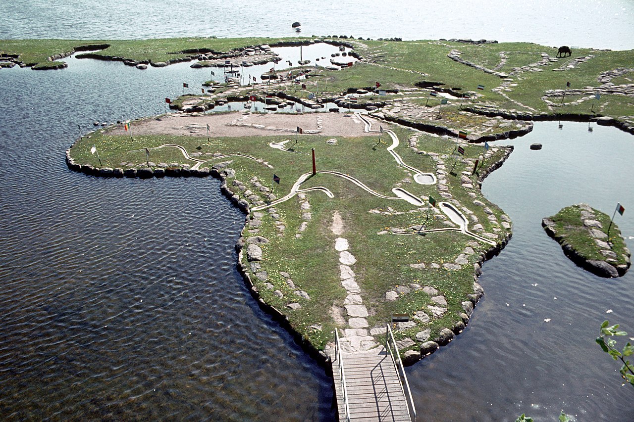
Verdenskortet ved Klejtrup Sø ( World Map at Lake Klejtrup ) Wikipedia body audio Αρχική Σκανδιναβία Δανία World Map at Lake Klejtrup Description Ο Παγκόσμιος χάρτης στη λίμνη Klejtrup (Δανικά: Verdenskortet ved Klejtrup Sø) είναι ένας μικροσκοπικός παγκόσμιος χάρτης χτισμένος από πέτρες και γρασίδι στο Klejtrup Sø κοντά το χωριό Klejtrup, δήμος Viborg, Δανία. 2 1 0 0 0 0 Υποβολή Επαναφορά More information Photographies by: Zones Δανία Σκανδιναβία Statistics: Position 4668 Statistics: Rank 180717 Προσθήκη νέου σχολίου Σχόλιο Σχετικά με τους μορφότυπους κειμένου CAPTCHA Security Code 193784526Click/tap this sequence: 3171 Esta pregunta es para comprobar si usted es un visitante humano y prevenir envíos de spam automatizado. Αποθήκευση Google street view Google street view Where can you sleep near World Map at Lake Klejtrup ? Booking.com What can you do near World Map at Lake Klejtrup ? Tollundmanden Tollund Man Aalborghus Lindholm Høje Den Gamle By ARoS Aarhus Kunstmuseum Aarhus Ø Aarhus Docklands Møllehøj Samsø Labyrinten Jellingstenene Λίθοι του Γιέλινγκ Jelling stone ship Rubjerg Knude Fyr Rubjerg Knude Lighthouse Legoland Billund Resort LEGO House Lego House (Billund) Slotved Skov Råbjerg Mile Den tilsandede kirke Sand-Covered Church Ladbyskibet Ladby ship Odense Όντενσε Grenen View more on the map 9.092.075 visits in total, 407.503 Points of interest, 405 Destinations, 1.019 visits today.
 12:19, 28 July 2009 (UTC) - CC BY-SA 3.0")


. - CC BY-SA 3.0")


![[node:title]](/sites/default/files/styles/640x320/public/default_images/default_0.JPG.webp?itok=aqV9zhFR)


Προσθήκη νέου σχολίου